.jpeg)
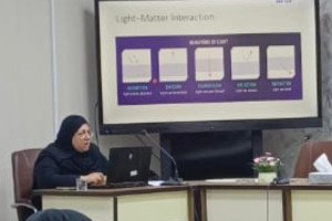
Ali Ramthan Hussein, a doctorate student at the Department of Geology, College of Science, gave a presentation on his dissertation research titled “Seismotectonic of Al-Refaei District and Surrounding Area from Seismological and Geophysical Data - Southern Iraq”.
For the last two decades, Al-Refaei district and surrounding cities such as Al-Neser, Qalat Suker, Al-Fajer, and Al-Hay experienced a number of small to moderate-size earthquakes that seem to be clustered in a relatively small area. To study the seismicity in this area, seven seismic stations were installed in Al-Refaei and several other stations in large cities in the south and central Iraq. Seismic data from these stations were used to conduct the research.
The results of analyzing the earthquakes indicate two seismic zones in the study area that are associated with local faults in a northwest-southeast trend. The first zone is located in Al-Hay city and an arrangement of earthquakes in trend NNW. The main reason for the activity of this zone is Ramadi-Musaiyib transverse fault. The second zone is located in Al-Refaei city and the main reason behind the seismic activity is Al-Refaei fault.
In this study, Al-Refaei fault was estimated by the seismological data and confirmed by the geophysical data. The results of integration between the seismological and 3D seismic data reveal that the Al-Refaei fault is an active reverse fault with 60˚ strike direction, 15˚ dip direction, and 43˚ dip angle. The researcher suggests that the reason behind the seismicity of Al-Reaei fault can be related to the oil activities at the Al-Gharraf oilfield, which means the seismic activity of Al-Refaei fault can be induced or man-made.

.jpeg)
