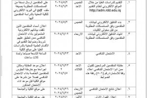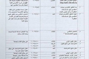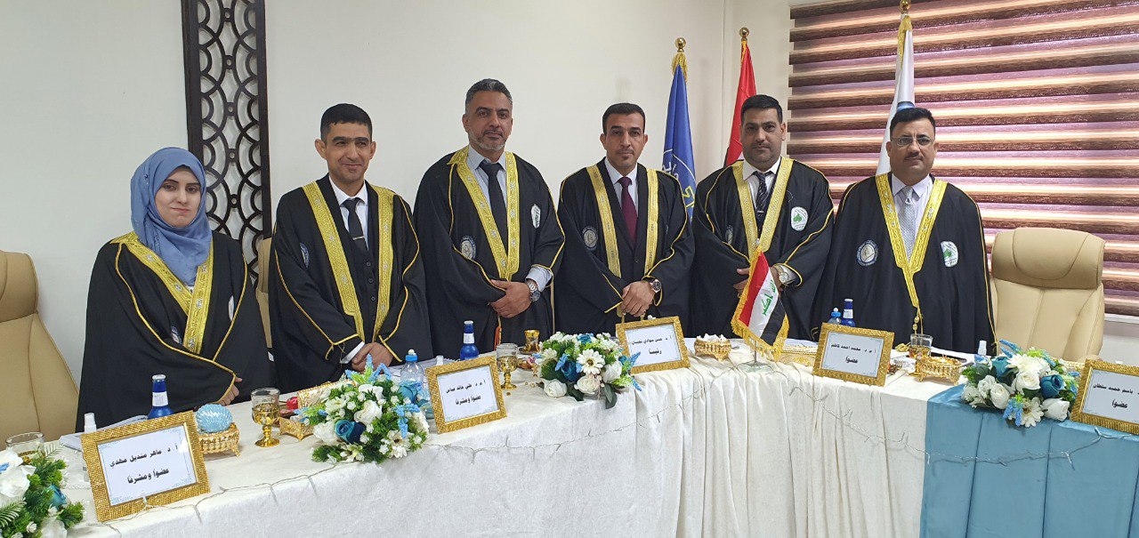
The Department of Geology, College of Science, discussed a master's thesis entitled (Stratigraphic Map of Lithology of Al-Bajaliyya, southeastern Iraq, using remote sensing and geographic information systems). The researcher Rehab Salem Shalal's thesis aims to identify the rock units and the stratigraphic boundaries of the Al-Bajaliya fold and to use spectral fingerprints and digital processing of satellite visuals to draw a stratigraphic rock map of the study area.
The study included conducting digital processing operations on Landsat 9 satellite visuals, using proportional visuals, and conducting the directed and non-directed classification process to determine the rock units of the fold, as it was found that the Injana Formation represents the core of the fold surrounded by the Muqdadiya Formation and covered by quaternary sediments, while the Bay Hassan Formation does not appear in the fold because it is stripped Completely, in addition to determining the stage of geomorphological development of the fold by conducting a hyposometric analysis, where it was found that the fold is in the stage of maturity and that it is in a state of balance between tectonic processes and the erosion process, and the gully erosion rates of the fold were calculated and the gully erosion map was drawn, and it was found that the fold is under the influence of the erosion rate High to very high.