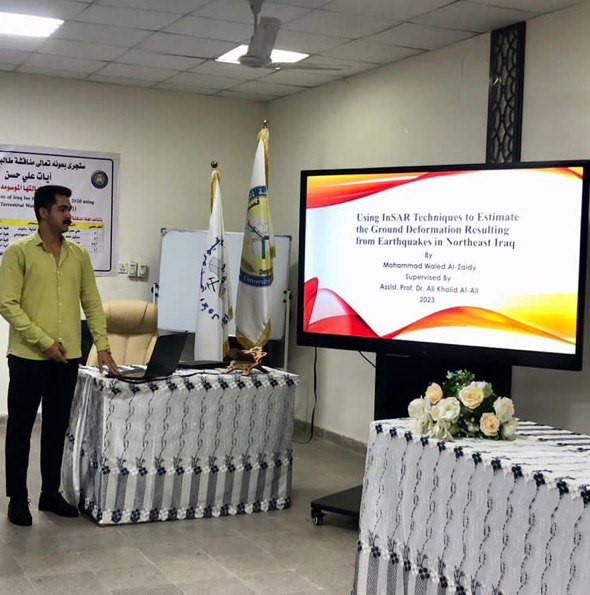
The Department of Geology at the College of Science organized a seminar entitled (Using InSAR techniques to estimate ground deformation resulting from earthquakes in northeastern Iraq). The seminar, in which the researcher Muhammad Walid Abdel-Amir lectured, aims to assess the applicability of radar satellite data, specifically Sentinel-1, to analyze and estimate ground deformation, displacement, and fault activity using InSAR technology, mapping deformation areas along the Iraqi-Iranian borders, and calculating the amount of displacement in them.
The study included collecting radar and seismic data covering the region, and then conducting several advanced processing operations for this data, which are related to the artificial aperture radar technology for interference, to find out and calculate the amount of deformation that occurred in the region due to devastating seismic tremors, and it gave successful results in identifying deformation areas.
The results concluded that the region located along the Iraqi-Iranian border has been subjected to very large deformation due to the large and devastating earthquakes that the region suffered, especially in two years (2017-2018), when the intensity of the earthquakes reached between (Mw5.3 - Mw7.3). The deformation extends from the north of the city of Amara to the north of the city of Sulaymaniyah. The maximum deformation was reached in two areas, the first in the Ezgeleh Sarpol-Zahab area, where the maximum height was about 100 cm and the minimum depression was about 40 cm. The second area is Mandali-Sumar, where the maximum height was about 20 cm.